Back to the Blue Lakes

I've been trying all summer to get back to the Mt. Sneffels Wilderness. This weekend I finally made it.
Sneffels has taunted me a second time.
Getting There
I left Santa Fe on Friday afternoon. The summer monsoons made for a comfortable, if gloomy, drive all the way to Pagosa Springs, where the skies finally began to clear.
Daylight faded somewhere between Coal Bank Pass and the Idarado mine. As twilight turned to night mule deer appeared, grazing by the roadside. They were so numerous that I decided to stop for the night at the Idarado.
The weather forecast was about right, with overnight temperatures in the mid-40s F. It wasn't long before the inside of the car cooled to match. Shivering, I fumbled around for the sleeping bag and crawled inside it.
I got back on the road just before 5 am, still a couple of hours away from the trailhead. I wanted to hike from the Blue Lakes trailhead up to Blue Lakes Pass, and to get there early enough to have the option of attempting the Blue Lakes route up Sneffels. The online guides call it a technical scramble; I hadn't brought a helmet, but I'm pretty sure people try it solo.
When packing for the trip I'd loaded up the overnight pack, thinking I might want to stay overnight at the Blue Lakes campground. With all of the camera equipment the pack weighed in at 55 lbs.
On arriving at the trailhead I decided I didn't want to lug all of that weight upwards for more than 2000 ft. Instead I transferred a bunch of stuff into the day pack.
Moving gear around like this led to the usual disorganization. Among other things, I forgot the variable neutral density filter. Oh well, I wouldn't be shooting much video. No doubt my friends would be relieved ☺
On the Trail
I was finally hiking by 0730. The temperatures were still in the 40s, but it was sunny and calm. Within a few minutes the exertion had warmed my aching, cold legs.
Steller's jays were making their raucous morning rounds. I wasn't fast enough to get any of them focused and exposed through the backlit foliage, before they moved on to the next tree.
At the edge of a clearing a red squirrel stood sentry at the base of a conifer. It scolded me for a minute while I took its picture. When it finally departed I turned back to the trail, only to discover that mule deer had been watching the whole exchange.

Mule deer leaving the lecture
Underwater Photography
I picked my way across the rocks to take picture from the middle of Dallas Creek. As I was finishing, a day-hiking couple arrived. They were just in time to see me slip and fall into the shallow stream. I landed on my right side with the camera completely under water. And then... I couldn't roll upright. My day pack was in the way. It probably took me ten seconds to regain my feet.
Why are there always witnesses? ☺

Dallas Creek at bath time
The camera is sitting in a bag of rice right now, drying out. I hope it isn't destroyed, but it may take a few more days of dessication to find out. [Update: it's on its way to the Panasonic service center. It would power on, but only slowly, and only if the LCD panel was closed.]
The mountain stream was cold and the air temp had climbed into the 50s. The morning was sunny, so instead of hypothermia I got a bracing half bath. No harm done.
I chatted with the couple for a bit. They were finishing a week in which they'd hiked about 26 miles, and they were planning to summit Sneffels. This gave me a little more desire to try it, especially since I had been making better time than they.
The log bridge at lower Blue Lakes had washed out. I eventually found a way across, carefully checking out the stones to make sure none of these had that special slippery film that I'd just learned about.
My self-made route missed the trail on the other side of Dallas Creek, but it did lead me up to a beautiful tributary waterfall.
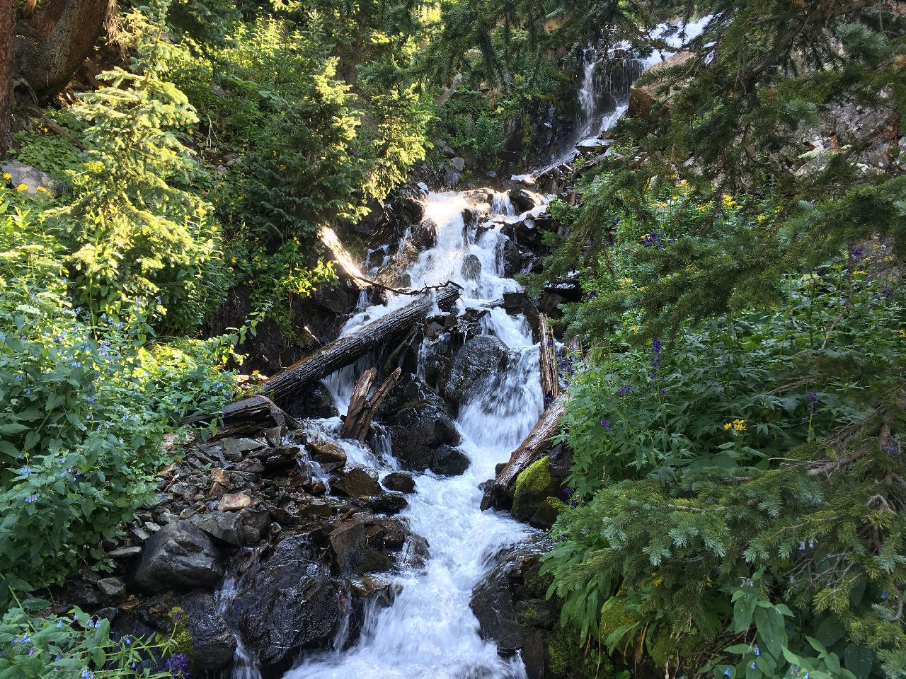
I took some pictures from atop a large fallen lodgepole pine, then scrambled up the mountainside to a rock pile where I knew the trail should be.
Starting up the switchbacks from the upper lake I met a guy who was running down from the pass. He had a "Mud Runners" hat on, with a Zia logo. Yet another New Mexican running down slippery trails that I need to take one tiny step at a time ☺ He modestly said that it would be a grind for him getting back to the top, but when he had seen the lake he just had to run down to it...
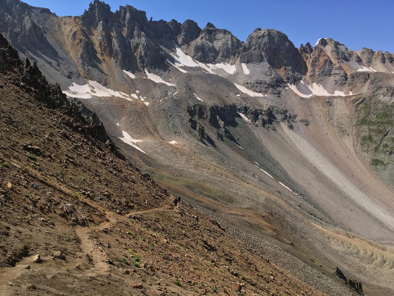
The runner jogged down this trail. I shuffled down it carefully.
I made it to the pass in really good time, feeling pretty happy despite the dead camera. It was only about 1130, and so far the sky held only small, scattered cumulus. It'd be at least a couple of hours before they turned into anything real.
The start of the trail to Sneffels from Blue Lakes Pass is heavily traveled and easy to spot. It begins to the left of the rocky spines that approach the summit.
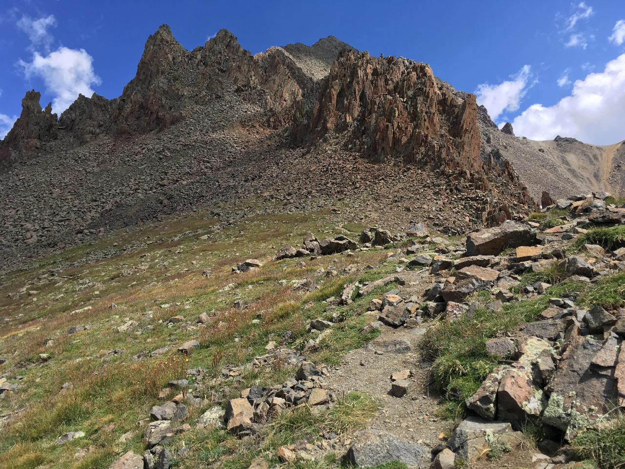
The start of the Blue Lakes route to Sneffels
Unfortunately, there are many variations, including some "trails" that are really just dirt left bare by natural erosion. I kept losing the path and having to pick my way back to it.
Once you get in among them the spires start to look like spikes sticking out of the earth, with passageways weaving maze-like among them. I kept scrambling up into the openings to see where I was, and to catch a glimpse of the crowds making their way up the Yankee Boy basin route.
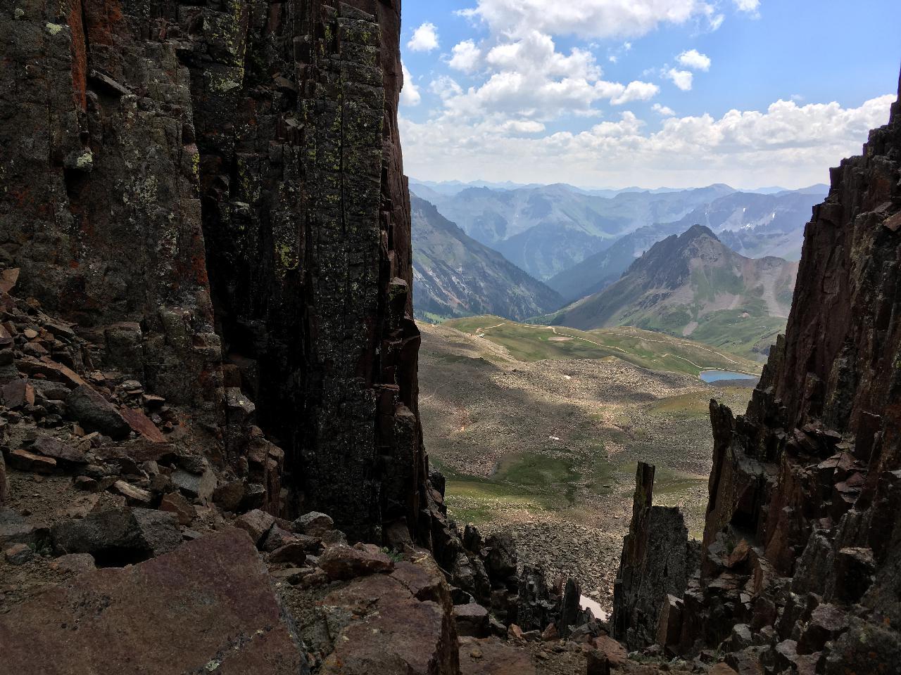
Looking through a gap towards the Yankee Boy Basin approach
Finally the dirt path faded away, and I began picking my way up a rocky chute. I wasn't sure I was anywhere near a route until I heard voices above me. About the same time I saw one cairn, then another. A head appeared, the first of a group of four or five. "Dude, there is nobody here." He said. Then he saw me, waved, and called back to his still hidden companions. I couldn't tell what he said, but it ended with "no monumental deal".
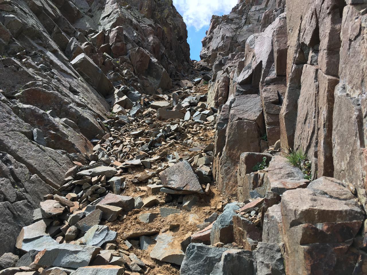
One of many rocky chutes
I reached the top of the chute and after a few moments picked out more cairns. They were set on shelves atop fairly vertical rock. I looked ahead, and all I could see was vertical rock. At the top, I saw someone standing. That must be the summit, and it was still a couple of hundred feet higher.

See the cairn, middle left? Yeah.
There's another one in the distance, but I can't pick it out in this photo.
Everybody has their limits. One of mine was, "I'm by myself. I'm not climbing up anything that I wouldn't feel comfortable down-climbing." I went on to the 2nd cairn, hoping that, from it, I'd see some path less vertical.
No joy. SummitPost wasn't kidding when they called this a 3rd class technical scramble.
[Google Earth says I should have looked left rather than up, at the last cairn. That is, there appears to be a good trail on the northwest side of the saddle ]

This is about as close as I got to the peak.
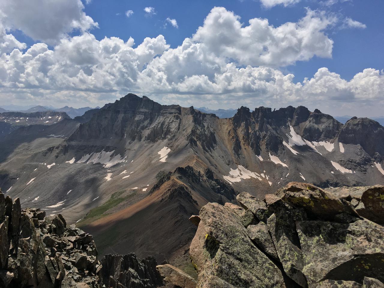
Summit or no, the views were spectacular. Blue Lakes Pass is bottom center, behind the rock in the foreground.
Who Ate the Bread Crumbs?
I turned around and started back up the chute I'd just descended.
Did I mention that the spires formed a sort of maze? It wasn't long before I took a wrong turn and got disoriented.
I should have stopped and looked back more often, on my way up. As it was, I "knew" only that the spires had almost always been on my right as I ascended, so they should be on my left going down.
Alas, what I knew was not true. After regaining the top of the chute I started down the other side. The spires were on the correct side, so I thought it was the one through which I'd passed the "no monumental deal" group.
But something didn't look right. I was sure I hadn't passed any snow on the way up. This chute had a bank of snow on its left side. I scrambled back up to the left, through a gap in the spires, hoping to find a match for my template: spires on the left, scree on the right.
Instead I saw the ridge leading off to Lavender Couloir to the east — the Yankee Boy route. I turned around and picked my way back to the top of the snowy chute. That had to be south or southwest facing, had to be the right direction.
In the distance I could see a small blue lake. I was so badly turned around that now I thought I must be looking out toward Blaine Basin (which would have been to the north or northwest and which, as far as I know, doesn't even have a lake).
Back to the Yankee Boy view. Back to the snow field.
There was dirty snow at the bottom of the snowy chute. It looked trampled, with pockets of brown that looked like a sequence of foot steps. Maybe this was just another variation up the Blue Lakes route. I decided to scramble down a bit and have a look.
"Scrambling" in this steep scree is difficult. It's too shallow for comfortable backward down climbing, but if you try to squat and step down, every move starts a small rock slide.
I got down to just above the snow. The chute was maybe six feet wide at its widest. It formed a "vee" about five or six feet deep, with dirty snow on the left extending all the way to the bottom, where the darker footprints started. On the right were big pieces of scree 3 to 5 feet long, cemented in place only by dried, dusty mud. The slope got steeper.
I still couldn't see well enough. Where did this chute come out? Where did the footprints turn, once they went out of view?
I was starting to get anxious now. It looked slightly easier to descend than to climb back out — everything I'd come down had slid the moment I put weight on it — but it wasn't clear that the chute didn't just drop away steeply. Still, maybe I could get down another couple of feet and get a better view.
And that's how I managed to reach a place where I really didn't want to be.
No Holds Barred
That rime-ice snow is the kind of stuff that, if you venture onto it while hiking in springtime, you immediately punch through. And those big pieces of scree? Only dusty dried mud held them in place, as I could now see much more clearly. And those footprints in the snow? They were just small bowls carved out by running snowmelt, which I could now see trickling out under the barely-anchored rocks.
I was now standing on dried mud on a slope that probably exceeded 45 degrees — and that felt like 60 — facing out. I hyperventilated a little.
I don't know how long it took, but I slowly and very carefully got turned around. This was a small improvement: I could no longer see the slippery chute that, when the first hold gave way, would send me arcing down the mountainside in a big smear of red.
On my right there was now a big piece of rock, cemented by mud, that joined the top of the snow. There were two holes in the dry mud beneath it, just big enough for a hand jam. Everything else was either sloping, or sitting loose.
The inner dialog began. "This sucks. I can either weight something that gives way and squirts me out, or... doesn't. All I really know is that I can't stay here."
Screw the inner dialog. I started talking out loud. "If I jam my hand in there, will it hold when I weight it?" Deep breath. Jam. Pull, just a little. It holds. "If I jam my foot in the other hole, will it hold?" Yes.
After what must have been 15 minutes of tediously debated moves, each accompanied by a sense of impending doom, I was back at the top of the chute.
Did you know? Even agnostics can be grateful, even when they're not sure to what they owe gratitude, for having been spared a painful experience.
Back among the spines, I was well satisfied that the snow chute was not the correct way down ☺ I decided to have another look through that gap, the one with the view toward the Yankee Boy route, with its spiny ridge across the saddle and the spires on the right. Maybe I'd be able to see a cairn or a dirty path if I looked again.
Heh. Yes, there was a big spire immediately to the right, on the "wrong" side of me. But that spiny saddle leading off into the distance? That was for Blue Lakes Pass, not Yankee Boy Basin.
I picked my way down, taunted once more by Sneffels but happy to have been not (quite) killed by my own stupidity.
Smoke If You Got 'Em
The rest of the day was less dramatic and very satisfying.
Coming down the switchbacks I saw thin weathered tree stumps appear, well above tree line: they were marmots, popping up straight to keep tabs on the late afternoon hikers.
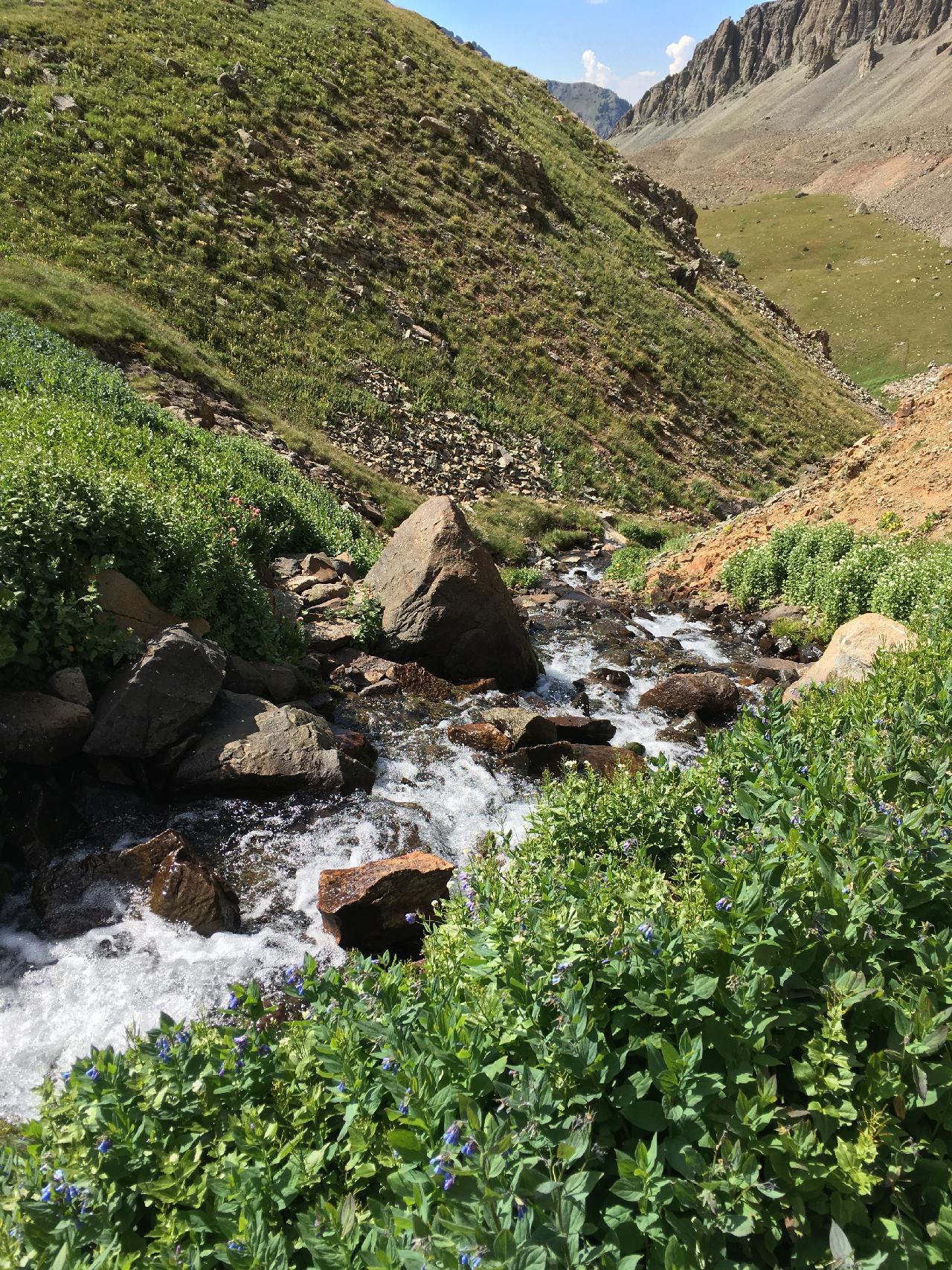
I paused to filter water where the stream cuts through the big glacial slump "levee" at the edge of the upper Blue Lake.
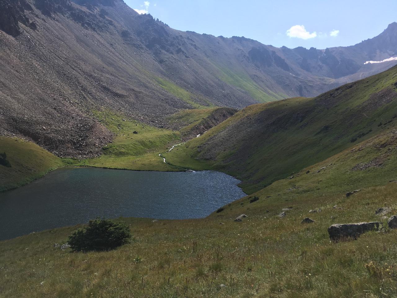
The uppermost blue lake drains through a cut in a slump of scree and dirt from the surrounding mountains. The lake itself may rest within a slump.
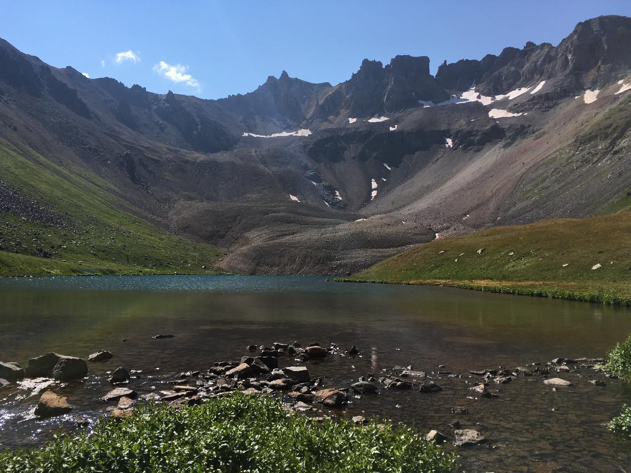
I think these mounds of scree and dirt are called glacial slumps. This one is on the south side of the uppermost blue lake.

I think this lake is fed only by the streams in the center of the image.
A bird was hopping around the grasses on either side of the stream, catching bugs and leaving tiny white droppings on the rock. Its size and movement reminded me of a dipper, but this was an above-water bird, and it filled a complementary niche: dippers catch larvae under the water, and this little thing was snatching adult insects above the stream.
Woodland Creatures
Following the trail instead of bushwhacking as I had on the way up, I came across the one pika that wasn't making noise. It stopped to watch me for a bit, clenching a long leafy stem in its mouth.
I passed several groups of humans on the way down through the forest. One family had a bell on their dog, to help alert bears. Another family was spread out, with a boy about seven and his younger sister ambling several hundred feet ahead of their parents.
Nearing the home stretch at about 1800, I came through a small opening in the pines. Here the trail was straight and almost level.
All of a sudden, bounding straight up the trail towards me is... a puppy? It has fluffy fur and a face like a Pomeranian. But the movement isn't quite right. It undulates.
It draws closer. Its fur is the same yellow gray as a grizzly. This can't be some kind of mutant bear cub, can it? Am I about to get mauled by its mother, whatever it is? But it's acting like a puppy happy to see its owner, round black eyes and all.
It's funny to recall each ill-fitting branch of the decision tree as my mind played a fast game of 20 Questions, trying to decode the scene. I was throwing relays and getting progressively nuttier answers. At the same time I was torn between delight at such a friendly approach and an uneasy feeling that I should be more cautious.
Earlier I had called out softly to the marmots and pikas, once they had seen me. I did the same now while reaching for my phone. That furry little thing was so close even the phone camera would yield a good picture.
"Hi there," I murmured. "What the heck are you?"
I wish I had kept my mouth shut. It was a weasel, a big one, and somehow it had not seen me until I spoke. It stopped, cocked its head for a moment while I fumbled for the phone, and then bounded off the trail, resuming the same pace. It was not at all worried, just bouncy and happy — and no doubt on its way to hunt down a meal.
That right there was worth the price of admission.
[Update 2020-03-30: watching the PBS Nature episode, "The Mighty Weasel," I suddenly saw that familiar furry face again: it had been a pine marten. ]
Signing Out
I got back to the trailhead at 1830. The register said the hiker couple, whom I'd last seen arriving at Blue Lakes Pass some 15 minutes after I had started into the spires, had returned at 1630. It wasn't their first time up, so maybe they actually summitted. Maybe I should have hung back and followed them!
The show wasn't quite over. The Stellers jays had been noisy at dawn, and they were at it again, calling out from all directions. It was growing dark, and the mule deer were emerging, cautiously grazing around the edge of the dirt parking area.
I put my pack in the car and idled off to find a camping spot. Mishaps notwithstanding, the day had gone really well: I'd climbed much quicker than five years ago and had made it back without a completely seized-up shoulder. My knees even felt better than the last time, though my right vastus lateralis (had to look that up), where it joined the knee, was so tight it was sore to the touch. And I had met my first wild weasel.

Goodbye Sneffels, until we meet again
and you taunt me a third time.
I wouldn't mind just driving back to this spot, when the aspen have turned.
Trailhead: 9350 MSL
Blue Lakes Pass: 13015 MSL
Sneffels Summit: 14105 MSL
I think I made it to about 13700 MSL.
Total distance about 14 miles according to my phone,
or about 11 according to Google Earth.
After: Wild and Dead
I can't end this post without paying respect to some unfortunate wild animals who had crossed paths with us and our machines.
Between Silverton and Durango I found a porcupine on the inside pullout of a sharp curve. I'd never seen one before, and was unlikely ever to get so close to one again. I took photos, trying to capture some of its extraordinary features.
As I put away the phone I noticed a few footprints leading to where the carcass lay. It hadn't been killed outright, but had crawled a short distance before expiring.

North American Porcupine — about two feet long
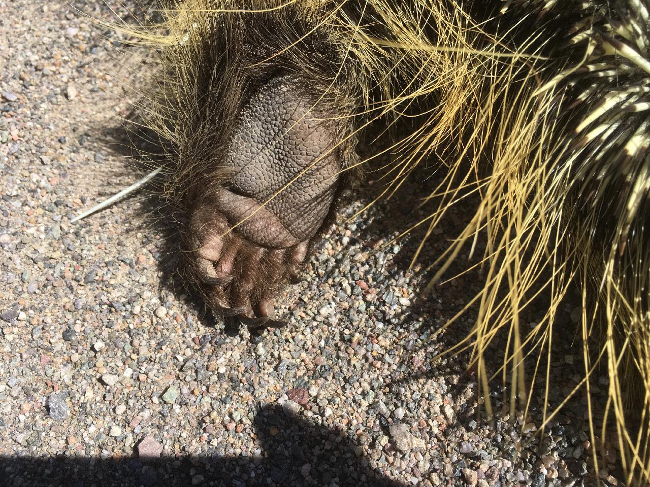
Pads and claws of the left hind foot
Ancestors of the porcupine rafted to the Americas from Africa, more than 30 million years ago.
Hours later, just south of the turn for the NM Wildlife Center in Española, Sunday evening traffic slowed down. Soon I saw why: in a section of highway enclosed by concrete barriers a large German Shepherd had been hit. Its head lay near the white road edge line, its large body extending toward the barrier.
But it was much too big for a shepherd, and its hind legs were much too thick.
It was a black bear. It left me wondering how, in this unusually wet, presumably food- and water-rich August, this poor creature had gotten trapped in this tunnel.